
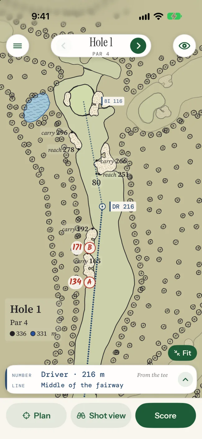
Hole 1
Par 5 · 568 yd
Plays south-west. 5 bunkers.
Golf course in San Isidro Ranch, Texas, USA
18 holes, par 72, about 7,040 yards (6,437 metres) along the hole lines. The par 3s are 5, 7, 12 and 14. The par 5s are 1, 9, 13 and 17. The longest hole is the 13th at 570 yd, the shortest the 7th at 147 yd. The map shows 44 bunkers. Water is in play on holes 2, 3, 4, 7, 8, 9, 12, 14, 15, 17 and 18.
Every hole, numbered, as the app draws it.
Each hole turned so it plays up the page, from the tee at the bottom.
Par 5 · 568 yd
Plays south-west. 5 bunkers.
Par 4 · 382 yd
Plays south-east. 3 bunkers and water.
Par 4 · 455 yd
Plays west. 1 bunker and water.
Par 4 · 381 yd
Plays south-east. Dogleg right. 3 bunkers and water.
Par 3 · 217 yd
Plays south-east. 1 bunker.
Par 4 · 428 yd
Plays north-east. Dogleg left. 3 bunkers.
Par 3 · 147 yd
Plays north. 1 bunker and water.
Par 4 · 405 yd
Plays north-west. Dogleg right. 3 bunkers and water.
Par 5 · 565 yd
Plays north-east. Dogleg left. 5 bunkers and water.
Par 4 · 405 yd
Plays east. Dogleg left. 3 bunkers.
Par 4 · 433 yd
Plays south-west. Dogleg right. 1 bunker.
Par 3 · 200 yd
Plays south-west. 3 bunkers and water.
Par 5 · 570 yd
Plays south. Dogleg left. 5 bunkers.
Par 3 · 147 yd
Plays west. 1 bunker and water.
Par 4 · 454 yd
Plays north. Dogleg right. 1 bunker and water.
Par 4 · 354 yd
Plays north-west. Dogleg left. 2 bunkers.
Par 5 · 514 yd
Plays east. Dogleg right. 4 bunkers and water.
Par 4 · 418 yd
Plays north-west. Dogleg left. 4 bunkers and water.
Lengths are measured along each hole's line on OpenStreetMap, so they can differ from the club's card. A bunker between two holes counts on both.
The app
On your iPhone and Apple Watch, Number & Line turns this map into a yardage book, with distances to the front, middle and back of each green from where you stand. You can plan each hole at home and get club advice from your own distances and the day's wind.
The app is coming soon to the App Store, and this course is already built for it.
Course map © OpenStreetMap contributors, under the Open Database Licence. See it on OpenStreetMap, where anyone can correct it. Green slopes: USGS 3D Elevation Program 1 m DEM (public domain). Our maps are open data too. Number & Line isn't connected with the club.